By Mara Scallon, communications graduate assistant in the Sustainability Office
A new crop of U community members has joined the Salt Lake City campus, and people are settling into classwork, research and learning. I am one of these new arrivals on campus and in Salt Lake City. Hello! My name is Mara, and I am a new student in the university’s Environmental Humanities graduate program and the Sustainability Office’s communications graduate assistant. I’ve moved here from the East Coast and had never been to Utah before arriving in early August. I have been eagerly exploring the new physical, historical and scholarly landscapes in which I find myself, and some of my settling in has required very intentional effort. As part of this process, I will visit and re-visit an outdoor space on campus to informally study and genuinely appreciate an outdoor space that characterizes and surrounds campus. I encourage you to join me in adopting some of these practices by finding your own outdoor space on campus or at least read along as I document my process.
My inspiration for focusing this series of blog posts on this particular topic came from multiple sources: a desire to get off the computer and outside and be able to call it work, an interest in repeatedly engaging with an outdoor location, a hope that there would be some benefits from engaging in a form of “forest bathing” (read more about this in my next blog post!) and an intention to slow down amidst the busyness of being on campus. The outdoor spaces on the University of Utah’s Salt Lake City campus do not come in the form of acres of forested or undeveloped land, so I found an accessible and dynamic environment along the edges of Red Butte Creek. The creek passes through several parts of campus, but I first saw it when walking around the Fort Douglas part of campus. I spend much of my on-campus time in or near Fort Douglas, and though it’s not possible to see the creek itself from my building, I can see some of the trees that border the creek. The crowns and upper branches of the trees reach up from behind chain-link fences, and it was clear to me that Red Butte Creek traveled from high up in the Wasatch Mountains and downhill into Salt Lake City here.
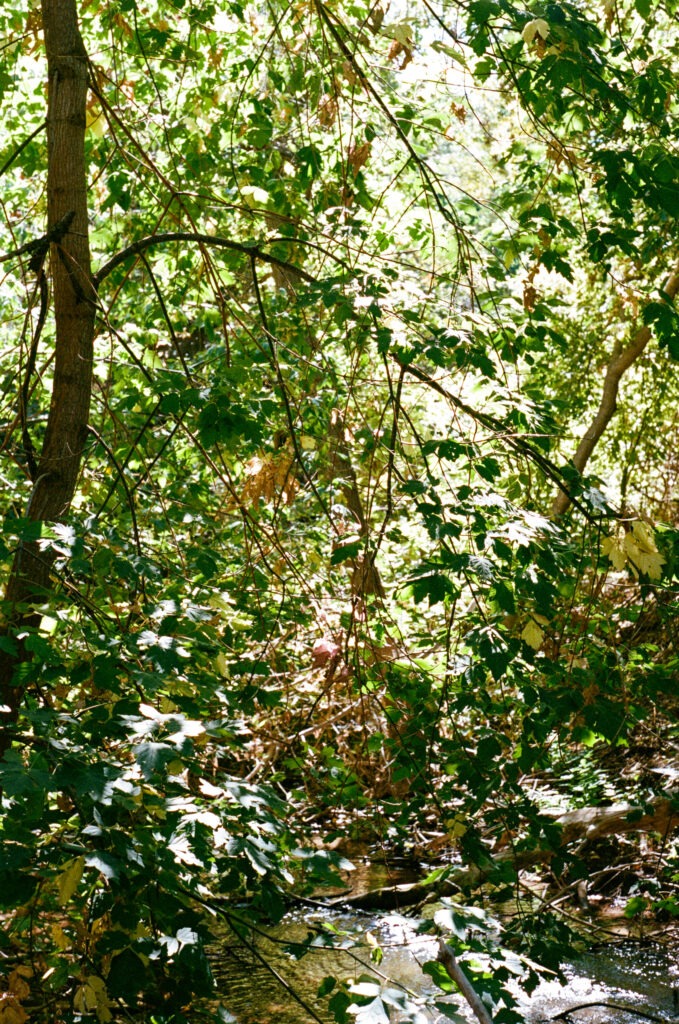
I walked along the creek one sunny day at the beginning of October, looking for a spot to sit where I could hear the water and lounge among the trees and plants that grow in the riparian (creekside/riverside) zone bordering either side of the creek. I found my spot and settled in, happily sitting in the dappled sunlight for an hour.

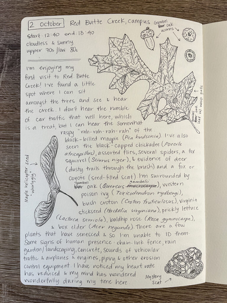
During that time, I identified a few species of trees and plants, caught sight and sound of a few winged visitors (both bird and bug!) and appreciated the constant burble of flowing water. I did use my phone, but differently than how I usually do when I am on campus—this time, I was using the Merlin Bird ID app and the Seek organism identification app to help me identify the organisms I was near. I focused on the bird calls, the gentle splashing of the water and the occasional whispers of wind through leaves. As time passed, I paid less attention to the sounds of vehicle traffic and more attention to the water, wind and bird songs. I practiced breathing slowly and deeply. I practiced focusing on what I could see and smell and hear right around me. I practiced being present and engaged in this opportunity to slow down during my busy, on-campus day.
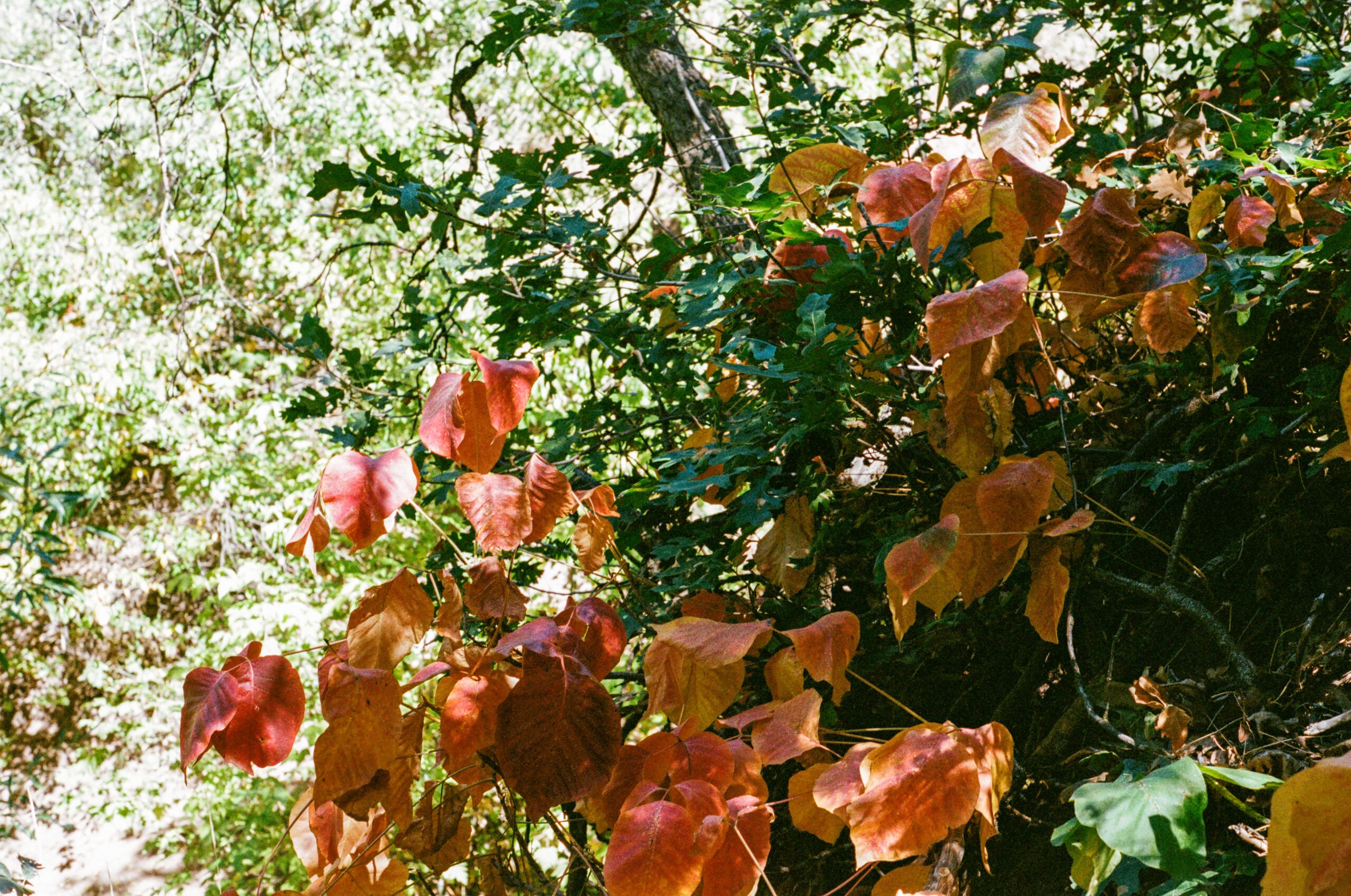
I really enjoyed my time spent sitting near the creek, admiring it in its early autumnal splendor and beauty. Some of the leaves had changed to brilliant yellows, yet most of the leaves were still bright greens. I thought about who and what was upstream from where I sat, and I thought about who and what was downstream from where I sat. I was thinking of the waterways in my past that I’ve known, and I was thinking of this creek and other yet-unknown waterways in my future that I will know.
I haven’t been higher along Red Butte Creek than my chosen spot, and I haven’t even made it up to the Red Butte Garden (yet!), which sits very close by and just above my spot. I haven’t hiked up into Red Butte Canyon, and if I do make it there one day, that will be exciting. For now, I am happy to see and visit my little spot which is located right about where the creek exits the canyon. I hope to learn more about how the creek shapes and is shaped by its biotic (living) and abiotic (non-living) inhabitants and neighbors, the Wasatch Front, the University of Utah community, the Salt Lake City community and the Great Salt Lake.
Just after I visited Red Butte Creek, I researched the creek to learn more about its significance to the region and its inhabitants. I learned it is a small creek that emerges from Red Butte Canyon, which is one of the smallest canyons on the Wasatch Front and is located between Emigration and City Creek Canyons. Red Butte Creek exists because water runoff from an area of approximately 11 square miles runs downhill and collects in the creek, which moves and drains to the west as it heads downhill, through and out of Red Butte Canyon. Red Butte Creek is 10.6 miles long and descends from higher-elevation semi-forested uplands to lower-elevation grasslands. The creek eventually passes through Red Butte Reservoir, Red Butte Gardens and the University of Utah campus before joining the Jordan River and flowing into the Great Salt Lake.
For the last 3.3 miles of its length, the creek is not aboveground as it is before and on the U’s campus, but it is buried underneath concrete. Though “buried” under concrete, the creek does still flow—but instead of winding creek banks of soil and plants, the creek quickly moves through concrete channels, allowing it to be controlled and used as a drinking water source for us human inhabitants of the Salt Lake Valley. Red Butte Creek is not the only creek to be treated and used this way. City Creek, Emigration Creek, Parley’s Creek, Mill Creek, Big Cottonwood Creek and Little Cottonwood Creek have all been buried at some point along their route, usually when they’ve reached the urban areas of the Salt Lake Valley. I live near Mill Creek and have seen places where that creek flows freely, where it flows in a concrete channel past houses and where it seems to vanish underground. Knowing that Red Butte Creek is buried in the same manner as Mill Creek, I can better appreciate my ability to sit alongside Red Butte Creek while it is still freely flowing and unburied.
The upper reaches of Red Butte Creek and Canyon are designated as a U.S. Forest Service Research Natural Area (RNA). RNAs are designated because the area’s unique characteristics are thought worthy of special protection and focused scientific research. The unique characteristics of Red Butte Creek are its proximity to an urban area and the fact that much of the creek above Red Butte Reservoir flows freely through mostly undeveloped land. (Undeveloped land here refers to land that has mostly trees, plants and rocks/soil on it rather than human-built infrastructure like roads, buildings, irrigation systems, etc.) It seems that the RNA designation was created so studies researching human impacts on landscape could be completed. This means that Red Butte Creek and Canyon were seen by the U.S. Forest Service as little-impacted by humans, but whether this is completely accurate remains somewhat unknowable since the Indigenous use and knowledge of the creek and canyon were not readily recorded by the Latter-day Saints when they moved into the region two centuries ago, and access to Indigenous knowledge and history by non-Indigenous communities is not always granted. Obviously, Red Butte Canyon and Creek had names and histories attributed to them before the Latter-day Saints arrived, but the resources I consulted did not have much information on how the members of whom we today call the Ute, Paiute, Goshute and Shoshone people would have described or interacted with and used this place. I did find one resource that described a Goshute-language name for the creek, but it was cited as being included in a book published in 1913 and I could not find additional information to corroborate or challenge this information. (Please note that the ethics and processes of learning and gathering Indigenous names for land features has changed over the past several decades, so this information may not be considered correct or reliable by modern standards and is why I have omitted it here.)
Though Red Butte Canyon may not be as developed as other nearby canyons, it has still been significantly impacted by its human neighbors and residents. Indigenous communities likely used the water, plant and animal resources found within Red Butte Creek and Canyon, and like later communities using these resources, they may have manipulated the landscape through creek damming, controlled burns and selective harvesting. For about a century after the Latter-day Saints arrived in the region in the 1840s, sandstone was quarried from the canyon for construction projects, which significantly altered overall water quality and plant and animal life downstream; the quarrying also would have changed how people used that same water as a resource for human drinking water, industrial purposes or other functions. By the 1850s, cattle grazing and timber harvesting along the creek were common, further polluting downstream water quality. Beginning in 1862, the U.S. Army declared the creek a federally protected watershed and began taking steps to limit public use of the creek and canyon. The Army did this to provide clean drinking water to its soldiers stationed at Fort Douglas, and Red Butte Reservoir was constructed to better control the water supply.
Today, in 2024, the creek retains its RNA designation and is host to a range of ongoing research projects, and the Red Butte Reservoir still holds thousands of gallons of water above the University of Utah campus, but the water is not used exclusively for Fort Douglas’ drinking water. The reservoir is now home to June sucker (scientific name: Chasmistes liorus), a funny-looking fish that is only found in Utah Lake and the lower reaches of its tributaries (the creeks and rivers that drain into the lake). The June sucker population was established within the Red Butte Reservoir as a “refuge population,” a population of this fish that could be used to assist in increasing the species’ numbers as many agencies worked to rescue the fish from its endangered species status. It seems the efforts are working as the June sucker is now classified as a threatened species, which is an improvement.
I learned much about Red Butte Creek from my computer-based research, but I anticipate that I will learn just as much by visiting in person and recording my own observations. I am excited to continue visiting this location, and I hope you’ll join me in finding your own place to visit, or by reading along as I document my own learning journeys. See you next time!

Works consulted:
A June Sucker History. (n.d.). June Sucker Recovery Implementation Program. https://junesuckerrecovery.org/history
Ehleringer, J. R., Arnow, L. A., Arnow, T., McNulty, I. B., McNulty, I. R., & Negus, N. C. (1992). Red Butte Canyon Research Natural Area: History, Flora, Geology, Climate, and Ecology. The Great Basin Naturalist, 52(2), 95–121.
Maffly, B. (2018, June 6). More than 30 years ago, all of Red Butte Canyon’s beavers were killed. Some Utah professors say now is the time to bring them back. The Salt Lake Tribune. https://www.sltrib.com/news/environment/2018/06/06/push-to-return-beavers-to-red-butte-canyon-picks-up-steam-but-some-worry-what-will-happen-to-popular-garden/
Red Butte Creek Profile. (2014, March 1). Seven Canyons Trust. https://sevencanyonstrust.org/blog/red-butte-creek
